Toggle navigation
GeoPunk.co.uk
Postcode Areas
Council Areas
STD Dialling Codes
Bus Routes
Sunrise and Sunset Times
Contact Us
Privacy Policy
Home
Post Code Areas
ST
Advertisement
Postcode District: ST Stoke-on-Trent
central coordinates: 52.935404245153,-2.103439305947
Map of the ST Stoke-on-Trent Postcode Area
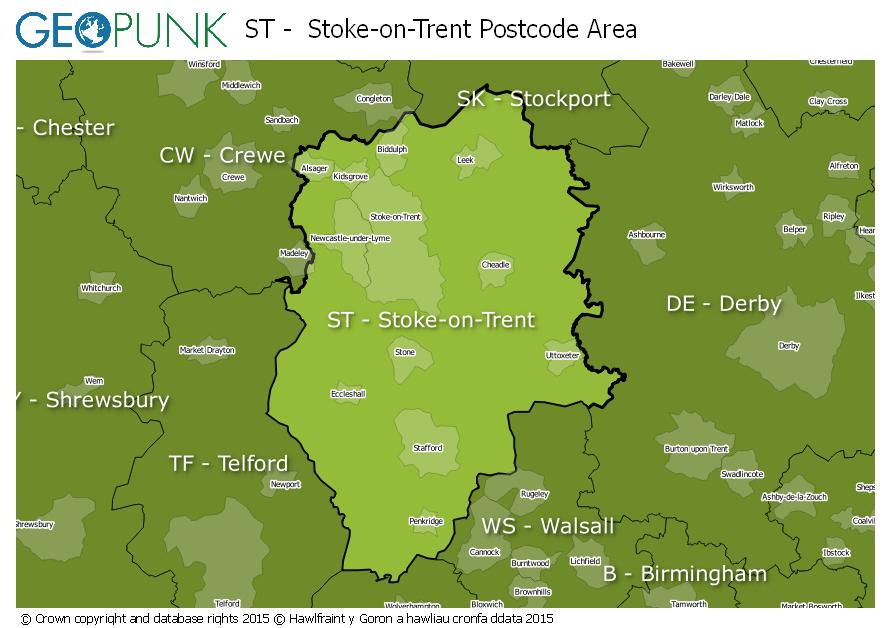
Local Authorities Within the ST Stoke-on-Trent Postcode Area
Cheshire East (B)
Derbyshire Dales District
Staffordshire Moorlands District
South Staffordshire District
Lichfield District
Shropshire
East Staffordshire District (B)
Newcastle-under-Lyme District (B)
City of Stoke-on-Trent (B)
Stafford District (B)
Advertisement
Postcode Districts within the ST Postcode Area
ST1
ST2
ST3
ST4
ST5
ST6
ST7
ST8
ST9
ST10
ST11
ST12
ST13
ST14
ST15
ST16
ST17
ST18
ST19
ST20
ST21
Towns and Villages Within the ST Stoke-on-Trent Postcode Area
Leek
Newcastle
Stafford
Stoke-on-trent
Stone
Uttoxeter
Advertisement
Postcodes Districts Within the ST Stoke-on-Trent Postcode Area
ST1 1
ST1 2
ST1 3
ST1 4
ST1 5
ST1 6
ST2 0
ST2 7
ST2 8
ST2 9
ST3 1
ST3 2
ST3 3
ST3 4
ST3 5
ST3 6
ST3 7
ST4 1
ST4 2
ST4 3
ST4 4
ST4 5
ST4 6
ST4 7
ST4 8
ST5 0
ST5 1
ST5 2
ST5 3
ST5 4
ST5 5
ST5 6
ST5 7
ST5 8
ST5 9
ST6 1
ST6 2
ST6 3
ST6 4
ST6 5
ST6 6
ST6 7
ST6 8
ST7 1
ST7 2
ST7 3
ST7 4
ST7 8
ST8 6
ST8 7
ST9 0
ST9 9
ST10 1
ST10 2
ST10 3
ST10 4
ST11 9
ST12 9
ST13 5
ST13 6
ST13 7
ST13 8
ST14 5
ST14 7
ST14 8
ST15 0
ST15 8
ST16 1
ST16 2
ST16 3
ST17 0
ST17 4
ST17 9
ST18 0
ST18 9
ST19 5
ST19 9
ST20 0
ST21 6