Toggle navigation
GeoPunk.co.uk
Postcode Areas
Council Areas
STD Dialling Codes
Bus Routes
Sunrise and Sunset Times
Contact Us
Privacy Policy
Home
Post Code Areas
SN
Advertisement
Postcode District: SN Swindon
central coordinates: 51.471291728632,-1.879210925556
Map of the SN Swindon Postcode Area
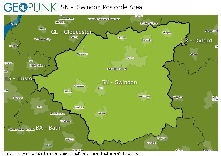
Local Authorities Within the SN Swindon Postcode Area
Swindon (B)
Test Valley District
Vale of White Horse District
West Berkshire
South Gloucestershire
Bath and North East Somerset
Cotswold District
Wiltshire
West Oxfordshire District
Advertisement
Postcode Districts within the SN Postcode Area
SN1
SN2
SN3
SN4
SN5
SN6
SN7
SN8
SN9
SN10
SN11
SN12
SN13
SN14
SN15
SN16
SN25
SN26
Towns and Villages Within the SN Swindon Postcode Area
Calne
Chippenham
Corsham
Devizes
Faringdon
Malmesbury
Marlborough
Melksham
Pewsey
Swindon
Advertisement
Postcodes Districts Within the SN Swindon Postcode Area
SN1 1
SN1 2
SN1 3
SN1 4
SN1 5
SN1 7
SN2 1
SN2 2
SN2 5
SN2 7
SN2 8
SN3 1
SN3 2
SN3 3
SN3 4
SN3 5
SN3 6
SN4 0
SN4 7
SN4 8
SN4 9
SN5 0
SN5 3
SN5 4
SN5 5
SN5 6
SN5 7
SN5 8
SN6 6
SN6 7
SN6 8
SN7 7
SN7 8
SN8 1
SN8 2
SN8 3
SN8 4
SN9 5
SN9 6
SN10 1
SN10 2
SN10 3
SN10 4
SN10 5
SN11 0
SN11 8
SN11 9
SN12 6
SN12 7
SN12 8
SN13 0
SN13 8
SN13 9
SN14 0
SN14 6
SN14 7
SN14 8
SN15 1
SN15 2
SN15 3
SN15 4
SN15 5
SN16 0
SN16 9
SN25 1
SN25 2
SN25 3
SN25 4
SN25 5
SN25 6
SN26 7
SN26 8