Toggle navigation
GeoPunk.co.uk
Postcode Areas
Council Areas
STD Dialling Codes
Bus Routes
Sunrise and Sunset Times
Contact Us
Privacy Policy
Home
Post Code Areas
PO
Advertisement
Postcode District: PO Portsmouth
central coordinates: 50.796621865255,-1.0558134466065
Map of the PO Portsmouth Postcode Area
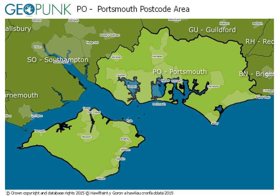
Local Authorities Within the PO Portsmouth Postcode Area
Arun District
Fareham District (B)
Gosport District (B)
City of Portsmouth (B)
Isle of Wight
Havant District (B)
East Hampshire District
Chichester District
Winchester District (B)
Advertisement
Postcode Districts within the PO Postcode Area
PO1
PO2
PO3
PO4
PO5
PO6
PO7
PO8
PO9
PO10
PO11
PO12
PO13
PO14
PO15
PO16
PO17
PO18
PO19
PO20
PO21
PO22
PO30
PO31
PO32
PO33
PO34
PO35
PO36
PO37
PO38
PO39
PO40
PO41
Towns and Villages Within the PO Portsmouth Postcode Area
Bembridge
Bognor Regis
Chichester
Cowes
East Cowes
Emsworth
Fareham
Freshwater
Gosport
Havant
Hayling Island
Lee-on-the-solent
Newport Iow
Portsmouth
Rowland's Castle
Ryde
Sandown
Seaview
Shanklin
Southsea
Totland Bay
Ventnor
Waterlooville
Yarmouth
Advertisement
Postcodes Districts Within the PO Portsmouth Postcode Area
PO1 1
PO1 2
PO1 3
PO1 4
PO1 5
PO2 0
PO2 7
PO2 8
PO2 9
PO3 5
PO3 6
PO4 0
PO4 8
PO4 9
PO5 1
PO5 2
PO5 3
PO5 4
PO6 1
PO6 2
PO6 3
PO6 4
PO7 4
PO7 5
PO7 6
PO7 7
PO7 8
PO8 0
PO8 8
PO8 9
PO9 1
PO9 2
PO9 3
PO9 4
PO9 5
PO9 6
PO10 7
PO10 8
PO11 0
PO11 9
PO12 1
PO12 2
PO12 3
PO12 4
PO13 0
PO13 8
PO13 9
PO14 1
PO14 2
PO14 3
PO14 4
PO15 5
PO15 6
PO15 7
PO16 0
PO16 7
PO16 8
PO16 9
PO17 5
PO17 6
PO18 0
PO18 8
PO18 9
PO19 1
PO19 3
PO19 5
PO19 6
PO19 7
PO19 8
PO20 0
PO20 1
PO20 2
PO20 3
PO20 7
PO20 8
PO20 9
PO21 1
PO21 2
PO21 3
PO21 4
PO21 5
PO22 0
PO22 6
PO22 7
PO22 8
PO22 9
PO30 1
PO30 2
PO30 3
PO30 4
PO30 5
PO31 7
PO31 8
PO32 6
PO33 1
PO33 2
PO33 3
PO33 4
PO34 5
PO35 5
PO36 0
PO36 8
PO36 9
PO37 6
PO37 7
PO38 1
PO38 2
PO38 3
PO39 0
PO40 9
PO41 0