GeoPunk.co.uk
  • Postcode Areas
  • Council Areas
  • STD Dialling Codes
  • Bus Routes
  • Sunrise and Sunset Times
  • Contact Us
  • Privacy Policy
  • Home
  • Post Code Areas
  • NN
GeoPunk

Postcode District: NN Northampton


central coordinates: 52.28111013456,-0.89156823856668

Map of the NN Northampton Postcode Area

map of the NN  Northampton postcode area

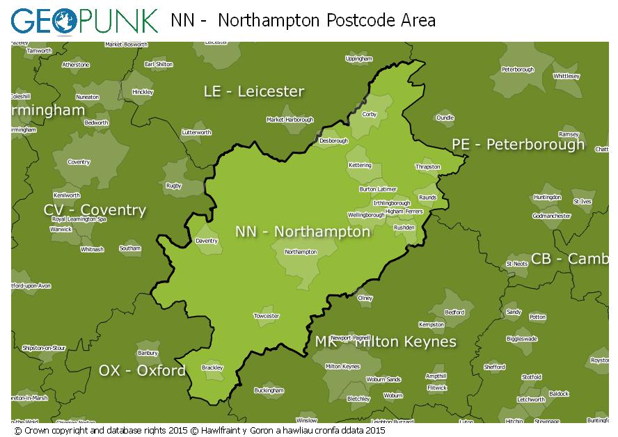
Local Authorities Within the NN Northampton Postcode Area

East Northamptonshire DistrictRugby District (B)Huntingdonshire DistrictSouth Northamptonshire DistrictDaventry DistrictBuckinghamshireRutlandWellingborough District (B)Kettering District (B)Milton Keynes (B)Harborough DistrictNorthampton District (B)Cherwell DistrictCorby District (B)Bedford (B)Stratford-on-Avon District
Advertisement

Postcode Districts within the NN Postcode Area

NN1NN2NN3NN4NN5NN6NN7NN8NN9NN10NN11NN12NN13NN14NN15NN16NN17NN18NN29

Towns and Villages Within the NN Northampton Postcode Area

BrackleyCorbyDaventryKetteringNorthamptonRushdenTowcesterWellingborough
Advertisement

Postcodes Districts Within the NN Northampton Postcode Area

NN1 1NN1 2NN1 3NN1 4NN1 5NN2 6NN2 7NN2 8NN3 2NN3 3NN3 5NN3 6NN3 7NN3 8NN3 9NN4 0NN4 5NN4 6NN4 7NN4 8NN4 9NN5 4NN5 5NN5 6NN5 7NN6 0NN6 6NN6 7NN6 8NN6 9NN7 1NN7 2NN7 3NN7 4NN8 1NN8 2NN8 3NN8 4NN8 5NN8 6NN9 5NN9 6NN10 0NN10 6NN10 8NN10 9NN11 0NN11 2NN11 3NN11 4NN11 6NN11 7NN11 8NN11 9NN12 6NN12 7NN12 8NN13 5NN13 6NN13 7NN14 1NN14 2NN14 3NN14 4NN14 6NN15 5NN15 6NN15 7NN16 0NN16 8NN16 9NN17 1NN17 2NN17 3NN17 4NN17 5NN18 0NN18 8NN18 9NN29 7


© geopunk 2025

© Crown copyright and database rights 2025

© Hawlfraint y Goron a hawliau cronfa ddata 2025