Toggle navigation
GeoPunk.co.uk
Postcode Areas
Council Areas
STD Dialling Codes
Bus Routes
Sunrise and Sunset Times
Contact Us
Privacy Policy
Home
Post Code Areas
ME
Advertisement
Postcode District: ME Medway
central coordinates: 51.325295064951,0.64778036749697
Map of the ME Medway Postcode Area
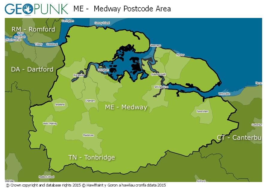
Local Authorities Within the ME Medway Postcode Area
Ashford District (B)
Maidstone District (B)
Swale District (B)
Canterbury District (B)
Medway (B)
Gravesham District (B)
Thurrock (B)
Tonbridge and Malling District (B)
Advertisement
Postcode Districts within the ME Postcode Area
ME1
ME2
ME3
ME4
ME5
ME6
ME7
ME8
ME9
ME10
ME11
ME12
ME13
ME14
ME15
ME16
ME17
ME18
ME19
ME20
Towns and Villages Within the ME Medway Postcode Area
Aylesford
Chatham
Faversham
Gillingham Kent
Maidstone
Queenborough
Rochester
Sheerness
Sittingbourne
Snodland
West Malling
Advertisement
Postcodes Districts Within the ME Medway Postcode Area
ME1 1
ME1 2
ME1 3
ME2 1
ME2 2
ME2 3
ME2 4
ME3 0
ME3 7
ME3 8
ME3 9
ME4 3
ME4 4
ME4 5
ME4 6
ME5 0
ME5 7
ME5 8
ME5 9
ME6 5
ME7 1
ME7 2
ME7 3
ME7 4
ME7 5
ME8 0
ME8 6
ME8 7
ME8 8
ME8 9
ME9 0
ME9 7
ME9 8
ME9 9
ME10 1
ME10 2
ME10 3
ME10 4
ME10 5
ME11 5
ME12 1
ME12 2
ME12 3
ME12 4
ME13 0
ME13 7
ME13 8
ME13 9
ME14 1
ME14 2
ME14 3
ME14 4
ME14 5
ME15 0
ME15 6
ME15 7
ME15 8
ME15 9
ME16 0
ME16 8
ME16 9
ME17 1
ME17 2
ME17 3
ME17 4
ME18 5
ME18 6
ME19 4
ME19 5
ME19 6
ME20 6
ME20 7