Toggle navigation
GeoPunk.co.uk
Postcode Areas
Council Areas
STD Dialling Codes
Bus Routes
Sunrise and Sunset Times
Contact Us
Privacy Policy
Home
Post Code Areas
LE
Advertisement
Postcode District: LE Leicester
central coordinates: 52.647359182985,-1.0235822544543
Map of the LE Leicester Postcode Area
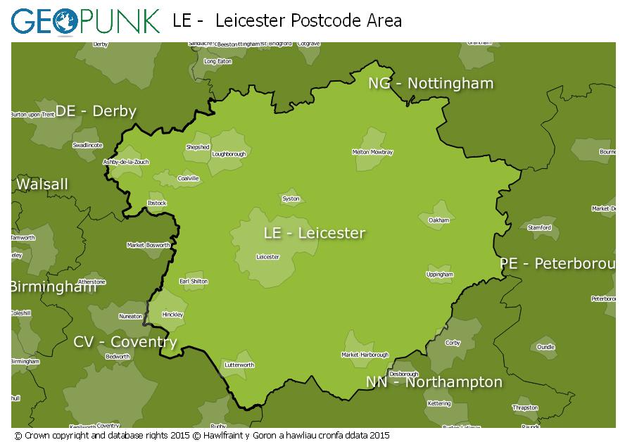
Local Authorities Within the LE Leicester Postcode Area
South Derbyshire District
South Kesteven District
Nuneaton and Bedworth District (B)
Daventry District
Rutland
Hinckley and Bosworth District (B)
Melton District (B)
Rushcliffe District (B)
Kettering District (B)
Harborough District
City of Leicester (B)
Blaby District
Corby District (B)
Charnwood District (B)
North West Leicestershire District
Oadby and Wigston District (B)
East Northamptonshire District
Rugby District (B)
Advertisement
Postcode Districts within the LE Postcode Area
LE1
LE2
LE3
LE4
LE5
LE6
LE7
LE8
LE9
LE10
LE11
LE12
LE13
LE14
LE15
LE16
LE17
LE18
LE19
LE65
LE67
Towns and Villages Within the LE Leicester Postcode Area
Ashby-de-la-zouch
Coalville
Hinckley
Ibstock
Leicester
Loughborough
Lutterworth
Market Harborough
Markfield
Melton Mowbray
Oakham
Wigston
Advertisement
Postcodes Districts Within the LE Leicester Postcode Area
LE1 1
LE1 2
LE1 3
LE1 4
LE1 5
LE1 6
LE1 7
LE1 9
LE2 0
LE2 1
LE2 2
LE2 3
LE2 4
LE2 5
LE2 6
LE2 7
LE2 8
LE2 9
LE3 0
LE3 1
LE3 2
LE3 3
LE3 5
LE3 6
LE3 8
LE3 9
LE4 0
LE4 1
LE4 2
LE4 3
LE4 4
LE4 5
LE4 6
LE4 7
LE4 8
LE4 9
LE5 0
LE5 1
LE5 2
LE5 3
LE5 4
LE5 5
LE5 6
LE6 0
LE7 1
LE7 2
LE7 3
LE7 4
LE7 7
LE7 9
LE8 0
LE8 4
LE8 5
LE8 6
LE8 8
LE8 9
LE9 1
LE9 2
LE9 3
LE9 4
LE9 6
LE9 7
LE9 8
LE9 9
LE10 0
LE10 1
LE10 2
LE10 3
LE11 1
LE11 2
LE11 3
LE11 4
LE11 5
LE12 5
LE12 6
LE12 7
LE12 8
LE12 9
LE13 0
LE13 1
LE14 2
LE14 3
LE14 4
LE15 6
LE15 7
LE15 8
LE15 9
LE16 7
LE16 8
LE16 9
LE17 4
LE17 5
LE17 6
LE18 1
LE18 2
LE18 3
LE18 4
LE19 0
LE19 1
LE19 2
LE19 3
LE19 4
LE65 1
LE65 2
LE67 1
LE67 2
LE67 3
LE67 4
LE67 5
LE67 6
LE67 8
LE67 9