Toggle navigation
GeoPunk.co.uk
Postcode Areas
Council Areas
STD Dialling Codes
Bus Routes
Sunrise and Sunset Times
Contact Us
Privacy Policy
Home
Post Code Areas
HX
Advertisement
Postcode District: HX Halifax
central coordinates: 53.724972768315,-1.9627809040223
Map of the HX Halifax Postcode Area
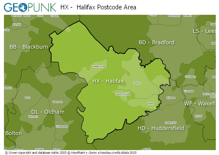
Local Authorities Within the HX Halifax Postcode Area
Bradford District (B)
Burnley District (B)
Kirklees District (B)
Oldham District (B)
Pendle District (B)
Calderdale District (B)
Rochdale District (B)
Advertisement
Postcode Districts within the HX Postcode Area
HX1
HX2
HX3
HX4
HX5
HX6
HX7
Towns and Villages Within the HX Halifax Postcode Area
Elland
Halifax
Hebden Bridge
Sowerby Bridge
Advertisement
Postcodes Districts Within the HX Halifax Postcode Area
HX1 1
HX1 2
HX1 3
HX1 4
HX1 5
HX2 0
HX2 6
HX2 7
HX2 8
HX2 9
HX3 0
HX3 5
HX3 6
HX3 7
HX3 8
HX3 9
HX4 0
HX4 8
HX4 9
HX5 0
HX5 9
HX6 1
HX6 2
HX6 3
HX6 4
HX7 5
HX7 6
HX7 7
HX7 8