Toggle navigation
GeoPunk.co.uk
Postcode Areas
Council Areas
STD Dialling Codes
Bus Routes
Sunrise and Sunset Times
Contact Us
Privacy Policy
Home
Post Code Areas
HU
Advertisement
Postcode District: HU Hull
central coordinates: 53.781799719137,-0.29569178871201
Map of the HU Hull Postcode Area
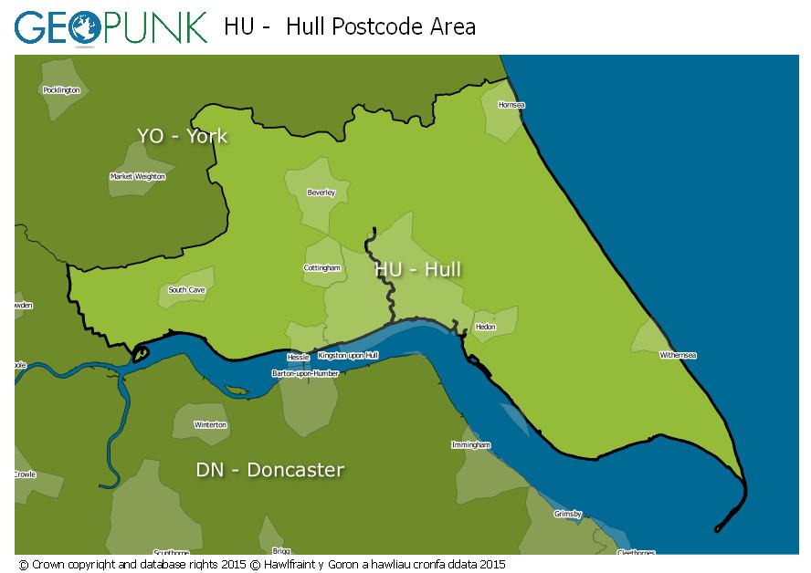
Local Authorities Within the HU Hull Postcode Area
North Lincolnshire (B)
City of Kingston upon Hull (B)
East Riding of Yorkshire
Advertisement
Postcode Districts within the HU Postcode Area
HU1
HU2
HU3
HU4
HU5
HU6
HU7
HU8
HU9
HU10
HU11
HU12
HU13
HU14
HU15
HU16
HU17
HU18
HU19
HU20
Towns and Villages Within the HU Hull Postcode Area
Beverley
Brough
Cottingham
Hessle
Hornsea
Hull
North Ferriby
Withernsea
Advertisement
Postcodes Districts Within the HU Hull Postcode Area
HU1 1
HU1 2
HU1 3
HU1 4
HU2 0
HU2 8
HU2 9
HU3 1
HU3 2
HU3 3
HU3 4
HU3 5
HU3 6
HU4 6
HU4 7
HU5 1
HU5 2
HU5 3
HU5 4
HU5 5
HU6 0
HU6 7
HU6 8
HU6 9
HU7 0
HU7 3
HU7 4
HU7 5
HU7 6
HU8 0
HU8 7
HU8 8
HU8 9
HU9 1
HU9 2
HU9 3
HU9 4
HU9 5
HU10 6
HU10 7
HU11 4
HU11 5
HU12 0
HU12 8
HU12 9
HU13 0
HU13 9
HU14 3
HU15 1
HU15 2
HU16 4
HU16 5
HU17 0
HU17 5
HU17 7
HU17 8
HU17 9
HU18 1
HU19 2
HU20 3