Advertisement
Postcode District: DE Derby
central coordinates: 52.962758241177,-1.585245817158
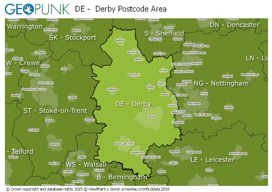
Map of the DE Derby Postcode Area

Local Authorities Within the DE Derby Postcode Area
North East Derbyshire DistrictDerbyshire Dales DistrictAmber Valley District (B)Hinckley and Bosworth District (B)Staffordshire Moorlands DistrictBolsover DistrictBroxtowe District (B)Rushcliffe District (B)Lichfield DistrictNorth Warwickshire District (B)City of Derby (B)East Staffordshire District (B)North West Leicestershire DistrictAshfield DistrictErewash District (B)South Derbyshire DistrictAdvertisement
Postcode Districts within the DE Postcode Area
DE1DE3DE4DE5DE6DE7DE11DE12DE13DE14DE15DE21DE22DE23DE24DE45DE55DE56DE65DE72DE73DE74DE75Towns and Villages Within the DE Derby Postcode Area
AlfretonAshbourneBakewellBelperBurton-on-trentDerbyHeanorIlkestonMatlockRipleySwadlincoteAdvertisement