
Argyll and Bute Council
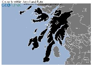
Map of the Argyll & Bute Council Area
The area shaded blue on the map represents the extent of Argyll & Bute Council. The map pin represents the location of the council offices.
Argyll & Bute Council has a population of 90,500.
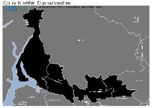
Argyll and Bute Council is within the ceremonial counties of Argyll and Bute and Dunbartonshire and
click to enlarge
Download Print Quality PDF of Councils in Argyll and Bute
click to enlarge
Download Print Quality PDF of Councils in Dunbartonshire
Councils Neighbouring Argyll & Bute Council
Wards within Argyll and Bute Council
click to enlarge
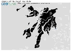
- South Kintyre
- Kintyre and the Islands
- Mid Argyll
- Oban South and the Isles
- Oban North and Lorn
- Cowal
- Dunoon
- Isle of Bute
- Lomond North
- Helensburgh Central
- Helensburgh and Lomond South
Download Print Quality PDF of Wards in Argyll and Bute Council
Argyll & Bute Council Contact Details
| Website | http://www.argyll-bute.gov.uk |
| Contact Us Page | http://www.argyll-bute.gov.uk/content/enquiriesform |
| Address | Kilmory |
| Town | Lochgilphead |
| County | Argyll |
| Postcode | PA31 8RT |
| Telephone Number | 01546 602 127 |
| Main Contact Email | enquiries@argyll-bute.gov.uk |
Details for Argyll and Bute Council
| Local Authority Name | Argyll and Bute Council |
| SNAC Code | 00QD |
| Postcode | PA31 8RT |
| Latitude | 56.0260564533 |
| Longitude | -5.42157874454 |
| Country | Scotland |
| NHS Health Authority | Highland |
| Parliamentary Constituency | Argyll and Bute |
| European Electoral Region | Scotland |
| Primary Care Trust | Argyll and Bute Community Health Partnership |
| Region | |
| Admin County | |
| ONS Code | S12000035 |
Political Make Up of Argyll & Bute Council
2022 Election Results for Argyll & Bute Council
| Council Seats up for Election | All |
|---|---|
| Scottish National Party | 12 |
| Labour | 1 |
| Liberal Democrats | 5 |
| Green Party | 0 |
| Conservatives | 10 |
| Others | 8 |
| Vacant Seats | 0 |