Rock Hill
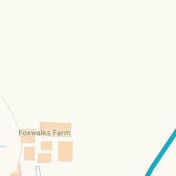
Map of Rock Hill in Bromsgrove
The Blue Map Markers Represent Postcode Locations, Click on them for details of the postcode.
Find Hotels and Places to Stay Near Rock Hill
Place of Worship near Rock Hill |
|---|
| St Peter's Catholic Church is 1034.29 metres away |
| St John the Baptist is 1952.32 metres away |
| New Song Community Church is 2453.54 metres away |
| All Saints Church is 3142.13 metres away |
| St Mary's Church is 3585.76 metres away |
| Holy Trinity & St Mary is 3643.62 metres away |
Shops near Rock Hill |
|---|
| Knights Pharmacy is 5130.39 metres away |
| The Jinney Ring Craft Centre is 5282.51 metres away |
| St Andrews Carpet Co. is 7313.76 metres away |
| Johnsons is 7355.68 metres away |
| Simply Furniture Droitwich is 7362.23 metres away |
| Droitwich Spa Funeral Service is 7369.11 metres away |
Public Houses (Pubs) near Rock Hill |
|---|
| The Golden Lion is 648.27 metres away |
| Dog and Pheasant is 1876.39 metres away |
| Queen's Head Inn is 2016.69 metres away |
| Navigation Inn is 2039.83 metres away |
| The Boat And Railway is 2807.93 metres away |
| The Crabmill is 3080.12 metres away |
Takeaways near Rock Hill |
|---|
| McDonald's is 4243.25 metres away |
| Pizzaman is 5135.28 metres away |
| Peking is 5140.69 metres away |
| Dildaar Balti is 5145.06 metres away |
| Mr Wong's is 5149.66 metres away |
| Catshill Fish Bar is 5151.49 metres away |
Cafes and Restaurants near Rock Hill |
|---|
| Rilys Bar & Restaurant is 2674.04 metres away |
| Spices is 5136.78 metres away |
Supermarkets near Rock Hill |
|---|
| ALDI is 1290.05 metres away |
| ASDA is 2204.60 metres away |
| Waitrose is 7234.49 metres away |
Is there anything missing? Let us know and we'll add it to our database.