Holly Lane
Holly Lane is a road
within the area of Bromsgrove District council within the Postcode district
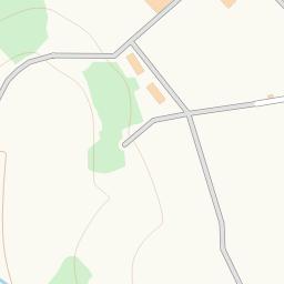
Map of Holly Lane
The Blue Map Markers Represent Postcode Locations, Click on them for details of the postcode.
Find Hotels and Places to Stay Near Holly Lane
Postcodes Near Holly Lane
Place of Worship near Holly Lane |
|---|
| St Aidans Wythall is 2632.40 metres away |
| Rowney Green Shared Church is 3110.28 metres away |
| Earlswood Methodist Church is 3176.90 metres away |
| Hollywood Christian Life Centre is 3846.96 metres away |
| St. Andrew's Church is 4011.52 metres away |
| St Mary Magdalene is 4218.42 metres away |
Shops near Holly Lane |
|---|
| Drinks World is 4737.55 metres away |
| Co-operative is 4744.93 metres away |
| Lloyds is 4745.42 metres away |
| New Dilshad is 4773.82 metres away |
| Tran's is 4778.02 metres away |
| Morrisons is 5572.08 metres away |
Public Houses (Pubs) near Holly Lane |
|---|
| Rose & Crown is 390.61 metres away |
| The Coach and Horses is 2527.68 metres away |
| The Village Inn is 2966.00 metres away |
| The Warwickshire Lad is 3299.76 metres away |
| The Peacock is 3712.91 metres away |
| The Bell is 4165.44 metres away |
Takeaways near Holly Lane |
|---|
| KFC is 5917.74 metres away |
| McDonald's is 6735.20 metres away |
Cafes and Restaurants near Holly Lane |
|---|
| Becketts Farm Restaurant & Conference Facility is 2518.09 metres away |
| Lakeside Cafe is 5066.62 metres away |
| Beefeater Grill is 5116.68 metres away |
| The Red Chamber is 5799.21 metres away |
| Costa Coffee is 6224.14 metres away |
| Miller & Carter is 6268.91 metres away |
Supermarkets near Holly Lane |
|---|
| Sainsburys is 5368.25 metres away |
| Lidl is 5812.31 metres away |
| Aldi is 6118.20 metres away |
| Tesco Metro is 6773.01 metres away |
Is there anything missing? Let us know and we'll add it to our database.