
Advertisement
Durham County Council
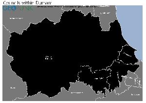
Map of the Durham County Council Area
The area shaded blue on the map represents the extent of Durham County Council. The map pin represents the location of the council offices.
Waste Recycling Performance
214 (62.39%) of local authorities perform better than Durham County Council.
128 (37.32%) of local authorities perform worse than Durham County Council.
Durham County Council has a population of 508,500.
Durham County Council is within the ceremonial county of Durham
click to enlarge
Download Print Quality PDF of Councils in Durham
Councils Neighbouring Durham County Council
Wards within Durham County Council
click to enlarge

- Coundon
- Coxhoe
- Craghead and South Moor
- Crook
- Dawdon
- Deerness
- Delves Lane
- Deneside
- Durham South
- Easington
- Elvet and Gilesgate
- Esh and Witton Gilbert
- Evenwood
- Ferryhill
- Framwellgate and Newton Hall
- Horden
- Lanchester
- Leadgate and Medomsley
- Lumley
- Murton
- Neville's Cross
- North Lodge
- Passfield
- Pelton
- Peterlee East
- Peterlee West
- Sacriston
- Seaham
- Sedgefield
- Sherburn
- Shildon and Dene Valley
- Shotton and South Hetton
- Spennymoor
- Annfield Plain
- Aycliffe East
- Aycliffe North and Middridge
- Stanley
- Aycliffe West
- Tanfield
- Barnard Castle East
- Tow Law
- Barnard Castle West
- Belmont
- Benfieldside
- Bishop Auckland Town
- Bishop Middleham and Cornforth
- Blackhalls
- Brandon
- Trimdon and Thornley
- Burnopfield and Dipton
- Tudhoe
- Chester-le-Street East
- Weardale
- Chester-le-Street North
- West Auckland
- Chester-le-Street South
- Willington and Hunwick
- Chester-le-Street West Central
- Wingate
- Chilton
- Woodhouse Close
- Consett North
- Consett South
Download Print Quality PDF of Wards in Durham County Council
Durham County Council Contact Details
| Website | http://www.durham.gov.uk/ |
| Contact Us Page | http://www.durham.gov.uk/article/1908 |
| Address | County Hall |
| City | Durham |
| County | County Durham |
| Postcode | DH1 5UL |
| Telephone Number Description | General Enquiries |
| Telephone Number | 03000 26 0000 |
| Main Contact Email | help@durham.gov.uk |
Details for Durham County Council
| Local Authority Name | Durham County Council |
| SNAC Code | 00EJ |
| Postcode | DH1 5UL |
| Latitude | 54.7856181496 |
| Longitude | -1.58414471182 |
| Country | England |
| NHS Health Authority | North East |
| Parliamentary Constituency | City of Durham |
| European Electoral Region | North East |
| Primary Care Trust | County Durham |
| Region | North East |
| Admin County | |
| ONS Code | E06000047 |
Waste and Recycling Rates for Durham County Council 2017-18
Waste Recycling Performance
214 (62.39%) of local authorities perform better than Durham County Council.
128 (37.32%) of local authorities perform worse than Durham County Council.

| Authority Type | Unitary |
|---|---|
| Waste per household KG | 551.6 |
| Percentage of household waste sent for reuse, recycling or composting | 40.00% |
| Collected household waste per person (kg) | 422.5 |
Employee Headcount for Durham County Council
FTE = Full Time Equivalent
| Region | North East |
|---|---|
| Total Headcount | 16144 |
| Total FTE | 12859 |
| Male Full Time | 3593 |
| Female Full Time | 6339 |
| Male Part Time | 673 |
| Female Part Time | 5539 |
| Permanent | 13991 |
| Temporary/Casual | 2153 |
| Male | 4266 |
| Female | 11878 |
| Full-time | 9932 |
| Part-Time | 6212 |
| Male Full Time perm | 3271 |
| Female Full Time perm | 5678 |
| Perm Male | 3697 |
| Perm Female | 10294 |
| Perm Full-time | 8949 |
| Perm Part-time | 5042 |
| Male total FTE perm | 3501 |
| Female total FTE perm | 8089 |
| Male Full Time temp | 322 |
| Female Full Time temp | 661 |
| Temp Male | 569 |
| Temp Female | 1584 |
| Temp Full-time | 983 |
| Temp Part-time | 1170 |
| Male total FTE temp | 357 |
| Female total FTE temp | 912 |